30.05.2025

The Future Smart Cities and Digital Innovations hackathon event held in April brought together a group of creative participants to envision what a smart city might look like in the future.
The Future Smart Cities and Digital Innovations hackathon event held in April brought together a group of creative participants to envision what a smart city might look like in the future.
Artificial intelligence, data analytics and smart infrastructure are essential tools for developing urban operations, and three outstanding teams considered solutions for the future. The event was organised by Location Innovation Hub partner Oulu University of Applied Sciences in collaboration with the Metacity Oulu project and Robocoast EDIH.
"Hackathons and our various innovation events have shown that they generate great ideas, some of which mature into commercial products. Our partners play a key role in this, as they have the infrastructure, expertise and networks on which innovations can be built," says Joonas Jokela, Customer Manager at Location Innovation Hub.
During the event, teams were formed and produced three promising prototypes. The hackathon showed how quickly and efficiently ideas can be turned into concrete solutions:
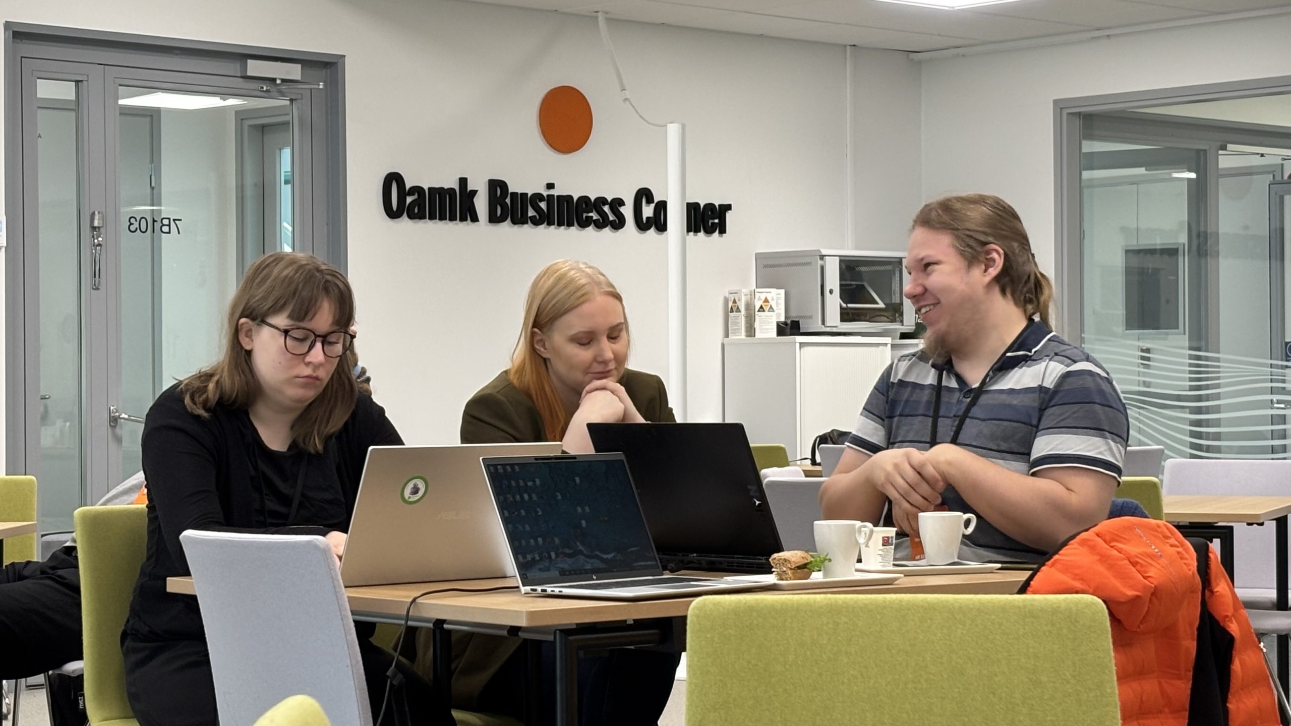
The hackathon, organised by Oulu University of Applied Sciences, brought together location data, technology young people's skills, and collaboration. The event generated some genuine innovation potential for smart cities of the future. Image: Oulu University of Applied Sciences
The atmosphere at the event was inspiring and encouraging. Participants were able to network, learn new things and challenge themselves under tight time constraints.
"This hackathon showed how important it is to combine location data, technology, young people's skills and cooperation. This creates genuine innovation potential for the smart cities of the future, " says Jaakko Palmunen, Spatial Data Data Expert at Oulu University of Applied Sciences.
Lauri Korhonen, an entrepreneur at Altisense Oy — a company that provides drone inventory services — was part of the winning team at the hackathon that developed tools for the predictive maintenance of infrastructure and real estate properties.
“The idea is to collect data using various sensors and use it to develop artificial intelligence-powered tools for large-scale data analysis. This will lead to savings in infrastructure maintenance costs, as data can be collected and analysed efficiently, and problem areas can be identified in advance," Korhonen explains.
The hackathon brought together people from very different fields of expertise.
“This was my first time participating in something like this, and it was important to be able to brainstorm with people from different areas of expertise. In a short period of time, a number of different perspectives emerged, each of which is valuable. The ideas that emerged are definitely worth pursuing," Korhonen reflects.
The organisers were inspired by how quickly the participants took on the challenges of smart cities and created innovative solutions.
"These demos have enormous potential for the cities of the future, as they creatively combine artificial intelligence, data analytics and smart infrastructure. The quality of the solutions was excellent, and the teams' ability to utilise location data and technology was particularly impressive, " says Palmunen.
The strengths of the Oulu region and the Oulu Innovation Alliance include connectivity expertise (6G), a state-of-the-art drone infrastructure, advanced location intelligence expertise and a dynamic innovation ecosystem, which create a unique platform for developing smart city solutions.
"Oulu is a pioneer in smart cities, and we enthusiastically support the emergence of new digital and green transition innovations. Through Hackathon events like this, the city of Oulu gains fresh perspectives on urban development," says Ari Saine, Smart City Relations Manager at City of Oulu.
Oulu University of Applied Sciences' test environments and extensive partner network offer excellent opportunities to develop the cities of the future. There are plenty of opportunities during the summer and autumn. ADL (Arctic Drone Labs) and LIH will next be featured at OIA-olkkari -event on 12 June.
In the autumn, Oulu Discovery Day will be held, where participants will have the opportunity to work hands-on with drones, as well as the Geomob Oulu location intelligence event, which brings together experts and innovators in the field. If you would like more information about the innovations created at the hackathon, the test environments offered by Oulu University of Applied Sciences, and the autumn drone event, please contact the Arctic Drone Labs.


