The Location Innovation Hub offers more than 30 different physical and virtual test environments. These test environments are available to our clients free of charge, in some specific cases for a small fee.
Our test environments provide a fast and efficient way to test new technologies or to see how a business idea works in a particular environment:
- Develop and test your AI solutions with High-Performance Computing.
- Manage, publish, and share location data with free GIS platforms and API software.
- Create touch-responsive visualisations and conduct user testing of 2D/3D data using our physical environments.
- Use virtual data visualisation environments and dashboards to visualise and publish data.
- Use forest point clouds, field data and smart farming technologies, and data.
- Test different indoor and outdoor positioning technologies and logistics solutions.
- Test drones of different sizes, payloads, and purposes in urban or forest environments.
Key to fast, safe and innovative digital product development
Test environments can be used to safely simulate different situations and ensure that a product works properly and meets, for example, regulatory requirements.
Test environments are the key to fast, safe and innovative digital product development - contact us if you have needs we can meet!

Smart Farming
Test and develop smart farming technologies.
Responsible organization(s):
Natural Resources Institute Finland (Luke)
Location:
Jokioinen, South-Western Finland
Description of the environment:
- Field area of 80 ha of experimental fields with smart farming equipment: ISOBUS systems, satellite tracking devices, weather stations, soilscouts
- Technological development facilities, i.e. building for devices assembly and tuning.
- Data collection of precision farming operations and the environment.
Purpose of use:
Testing machinery, devices, and software in a real agricultural environment, i.e. precision farming fields.
Access/user rights:
Physical access: By application.
Remote access: By application.
Access protocol will be launched in 2024. Contact the Location Innovation Hub.
Notes/Restrictions:
Use by fee, pricing per extent of use.
Services only under the guidance of Luke’s personnel.
- Cultivation: No GMO plants allowed, restrictions for some plant protection agents.
- DNSH rules.
More information:
Providing organisation(s)
Finnish Geospatial Research Institute FGI
Description of the test environment
Location Finland data platform brings together data sources and offers data through modern OGC APIs to support innovation and easy experimentation. Datasets are available in several themes: Built Environment, Forestry, Agriculture and Food, Transportation, Health and Wellbeing and Climate along with essential location reference data such as orthophotos. You can easily explore the data via our Explore page. New datasets are made available based on customer needs and ideas.
Purpose of use
Location Finland is a test-before-invest service for startups and small and medium-sized enterprises to innovate and develop new location-based solutions and business in Finland. Spatial data available via OGC APIs offer possibilities for developers and other data enthusiasts to innovate and test new ideas, solutions and applications.
Use case(s)
With several datasets from different themes available via OGC APIs, new possibilities emerge to combine data in unexpected ways and build innovative location-based solutions. You can integrate data seamlessly into your own code or access it through geospatial software like QGIS. To inspire your work, we also provide example use cases in areas of smart farming and smart cities.
Access / user rights
You can get an API key in seconds by submitting the form on our website.
Notes / restrictions
The service is intended for testing purposes. It cannot be used for commercial or operational services. The API key can only be used by businesses and organisations within the European Union. Private use is not allowed. The conditions of the original data and interface providers apply.
Required skills
- Basics of APIs (Application Programming Interfaces)
- Basics of querying OGC API - Features and OGC API - Coverages
- Basic programming knowledge or experience of geospatial software like QGIS
- Understanding of geospatial data
More information

Innovative Forestry
Use our forest point clouds and field data.
Responsible organization(s):
Finnish Geospatial Research Institute (FGI), Department of Remote Sensing and Photogrammetry, University of Eastern Finland
Location:
Evo and Hyytiälä, Finland
Description of the environment:
The SCAN FOREST will include approximately 10,000 individual trees measured with laser scanning at an unprecedented level of detail.
Purpose of use:
Comparison of different drone and earth observation methods for measuring tree structure. Test track for testing localization / positioning methods.
Access/user rights:
Contact the Location Innovation Hub.
Notes/Restrictions:
Open data available.
For comparison studies and analyses carried out by FGI/UEF fees may apply.
More information:
Providing organisation(s)
Finnish Geospatial Research Institute FGI
Description of the test environment
Permanent laser scanning station, FGI LiPhe, developed for long-term forest monitoring. The system has collected hourly point cloud time series of a forest site since April 2020 with two maintenance breaks in winter 2021/2022 and in winter 2025/2026.
Purpose of use
The data set is spatio-temporally dense and unique in world with its total length and point density. The time series can be used for developing and testing multi-temporal point cloud tools, or in developing multi-year forest growth models.
Use case(s)
Access / user rights
Notes / restrictions
In general, LiPhe station data and methods are open. Due to the massive dataset size, and processing and personnel limitations, making non-preprocessed data available takes time.
Required skills
- Knowledge on laser scanning point clouds
- Knowledge on software or programming languages that can process .LAS/.LAZ format
- Experience with Python and R
- Experience with GIS software
More information
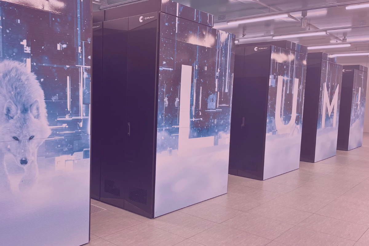
High-Performance Computing & AI
Develop and test your artificial intelligence solutions.
Responsible organization(s):
CSC IT Center for Science
Location:
Espoo / Kajaani
Description of the environment:
LUMI is one of the world's fastest supercomputers and can be used to scale up processing and analysis of geospatial and other data. CSC and partners provide a selection of pre-installed software of different fields, but users may also install their own software. LUMI has also an object storage where big amounts of data can be stored and shared with collaborators.
Purpose of use:
LUMI is particularly useful for Deep Learning purposes, because it has a very powerful GPU partition. Also, big data processing and high throughput computing (small tasks but many of them) are very suitable tasks for the supercomputer CPU partition.
Access/user rights:
LUMI is funded by the European High-Performance Computing Joint Undertaking (EuroHPC JU) and LUMI consortium of ten European countries, which CSC coordinates.
Location Innovation Hub offers consultation and support. Contact us.
Notes/Restrictions:
LUMI offers several computing partitions and capacities. All the capacities are accounted in three types of units, GPU (graphics processing unit) hours, CPU hours (central processing units), and storage hours. All projects on LUMI are applied and resourced as a combination of these three units. CSC also provides support for using LUMI.
Please see different collaboration models and pricing list at CSC.fi, including free of charge testing.
More information:
For more information, visit CSC High Performance Computing for Companies website and LUMI Supercomputer Website.
Responsible organization(s):
Finnish Geospatial Research Institute
Location:
Digital
Description of the environment:
We gathered more than 15 Artificial Intelligence (AI) reference solutions related to location data within our partner network. Solutions vary between deep learning methods of feature recognition and mosaic extraction from satellite images.
Purpose of use:
Depending on the solution, this test environment includes source codes, training data sets, documentations, or scientific publications. Also, technical consultation is possible with our AI specialists.
Access/user rights:
In most cases, solutions and consultation are open to use for LIH clients. Our goal is to further increase openness and availability of the solutions as.
Notes/Restrictions:
Some solutions, especially their training data sets might not be open for everyone. This is because of security risks or license challenges. Feel free to ask more locationinnovationhub@nls.fi.
More information:
See our website or contact us directly Email: locationinnovationhub@nls.fi
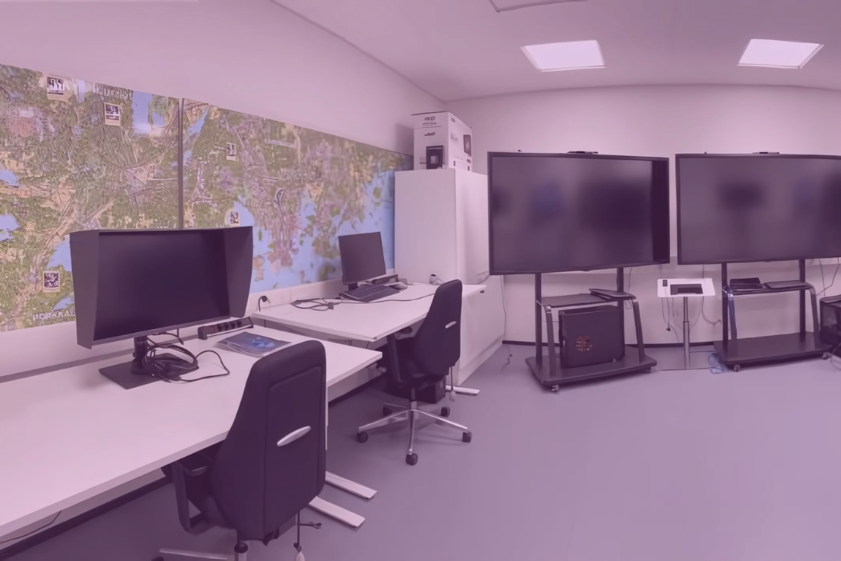
Visualisation Labs
Create touch-responsive visualisations and conduct user testing of 2D/3D data using our physical environments.
Responsible organization(s):
Aalto University, the Research Institute of Measuring and Modeling for the Built Environment (MeMo)
Location:
Puumiehenkuja 5A, Espoo
Description of the environment:
The Aalto 3D Studio is a physical space focused on advancing the utilization and visualization of real-world 3D data. The 3D Studio and its assets contain data, state-of-the-art equipment, and research personnel that are available for cooperation partners of Aalto University.
Purpose of use:
The 3D Studio acts as a scientific platform aimed for academic research and education, as well as a platform for businesses and organizations willing to cooperate with Aalto University.
Access/user rights:
Access to the 3D Studio can be provided in collaboration with Aalto MeMo staff. Contact the Location Innovation Hub.
Notes/Restrictions:
The use of 3D Studio is limited to active cooperation partners of Aalto University and for non-commercial use.
More information:
Responsible organization(s):
Finnish Geospatial Research Institute (FGI), Department of Geoinformatics and Cartography
Location:
Vuorimiehentie 5, Espoo
Responsible organization(s):
Finnish Geospatial Research Institute (FGI), Department of Geoinformatics and Cartography
Location:
Vuorimiehentie 5, Espoo
Description of the environment:
FGI Geovisualisation laboratory in the Finnish technological hub Otaniemi enables setting up versatile visualisation configurations for effective communication of visual information to targeted users.
Laboratory focuses particularly in geoinformatic and cartographic visualisation.
Equipment:
- High-end VR and xR headset with eye-tracking capability
- 250Hz static eye-tracking camera and software
- Five large movable 75” multi-touch displays for cave constellations
- 55” high-sensitivity display
- Profile-calibrated wide gamut desktop display for high-quality graphical design
- Display colour calibration equipment
- Adjustable ambient lighting
Purpose of use:
Research and development of geovisualisation techniques and concepts
Access/user rights:
Laboratory is available for research and development purposes in collaboration with FGI researchers. Contact Geoportti or pyry.kettunen(a)maanmittauslaitos.fi.
Notes/Restrictions:
Based on agreement.

Drone and Autonomous Vehicle Test Sites
Test drones of different sizes, payloads and purposes in urban, rural, agricultural or forest environments. Test autonomous vehicles in a closed environment.
Responsible organization(s):
Finnish Geospatial Research Institute (FGI), Department of Remote Sensing and Photogrammetry
Location:
Virtual flight restriction areas around Espoo Otaniemi and Helsinki Jätkäsaari
Description of the environment:
Temporal danger areas (tempo-D) “Espoo-Otaniemi EFD816” and “Helsinki-Jätkäsaari EFD817”. Temporal danger area for drone flights, needs to be activated via NOTAM beforehand. Both tempo-Ds have two different sub-areas that can be activated separately. Maximum flying height is 150 m AGL (500 ft MSL). Area of Espoo-Otaniemi is ~ 4.2 x 3.6 km, Helsinki-Jätkäsaari ~ 10 x 6 km
Purpose of use:
These tempo-Ds are meant for temporal drone operations, such as different drone imaging or cargo delivery etc. demonstrations around Espoo-Otaniemi or Helsinki-Jätkäsaari. MML FGI created these tempo-Ds so that it would be easier and faster for different organizations to perform drone test flights in urban areas. Usage of the tempo-Ds is limited to FGI and their partners. Professional drone operators with permissions to fly over densely populated areas can use these tempo-Ds, but they must contact FGI.
Access/user rights:
Contact the Location Innovation Hub.
Notes/Restrictions:
Tempo-D user must have aviation radio with permission to communicate with it, and follow drone-frequency 133.325 MHz. Users also need to follow FinnHEMS helicopters via ADS-B in system, and if they notice FinnHEMS emergency flights they must terminate their drown operation immediately.
Direct costs resulting from extra work will possibly be invoiced.
More information:
Responsible organization(s):
Finnish Geospatial Research Institute (FGI), Department of Remote Sensing and Photogrammetry
Location:
Vihti, Finland EFD814
Description of the environment:
A Tempo-D airspace reservation (EFD814) and collaborator network for agricultural test fields.
Purpose of use:
A 14.5 km² test area for developing and testing agricultural drone and satellite remote sensing applications.
Access/user rights:
Contact the Location Innovation Hub.
Notes/Restrictions:
Direct costs resulting from extra work will possibly be invoiced.
More information:
Responsible organization(s):
Finnish Geospatial Research Institute (FGI), Department of Remote Sensing and Photogrammetry
Location:
Evo, Finland
Description of the environment:
A Tempo-D airspace reservation (EFD818) and collaborator network for forestry applications.
Purpose of use:
A 40 km² test area for developing and testing forestry drone and satellite remote sensing applications.
Access/user rights:
Contact the Location Innovation Hub.
Notes/Restrictions:
Direct costs resulting from extra work will possibly be invoiced.
Providing organisation(s)
OAMK
Description of the test environment
The test area is a large temporary reserved danger area in Northern Finland, covering coastal, island, rural and urban-adjacent environments. It enables drone operations up to 1700 ft AGL within defined sectors. Critical sites are excluded, allowing safe testing close to real operational conditions.
Purpose of use
The area is intended for professional UAS testing, development and validation. It supports safe experimentation of advanced drone operations, system integration, and operational concepts that require segregated airspace and flexible altitude use.
Use case(s)
The area enables testing of drone-based logistics such as autonomous cargo transport, medical deliveries, spare parts distribution and island logistics. Use cases include BVLOS route planning, multi-stop delivery, ground handling interfaces, weather resilience, detect-and-avoid solutions, and integration with manned aviation procedures in near-controlled airspace.
Access / user rights
Access is granted to approved operators through the area owner/operator. Users must follow agreed operational procedures and airspace activation rules. Separate approvals may be required depending on operation type and equipment.
Notes / restrictions
The area is activated by NOTAM and availability is not guaranteed at all times. Hospitals, prisons and other protected sites are excluded. Operations must comply with current aviation regulations and published activation conditions.
Required skills
-
Operators using their own equipment must hold the required aviation authorizations, certificates and operational approvals according to applicable UAS regulations and the intended category of operation.
Costs
Access fees and service costs are defined case‑by‑case based on operation scope, duration, support services and infrastructure needs.
More information
Providing organisation(s)
OAMK, VTT
Description of the test environment
UAS scenarios. Airspace up to FL90 (9,000 ft AMSL) supports demanding and BVLOS operations, including drones using 4G/5G connectivity to maximum altitude. Year‑round testing across four seasons, especially in cold and Arctic conditions, enables realistic assessment of system performance, robustness, and reliability.
Purpose of use
Testing at OuluZone aims to validate and mature unmanned aviation systems and subsystems in realistic conditions, with emphasis on cold and Arctic environments. The facilities support demanding use cases such as BVLOS, network‑connected UAS concepts, and high‑altitude flights to assess performance, robustness, and reliability. The testing services are intended for developers, integrators, research bodies, authorities, and end users of civil, security, and dual‑use UAS solutions.
Use case(s)
OuluZone is currently used for testing and validation of unmanned aerial systems and related subsystems in demanding operational conditions, with a strong focus on cold, winter, and Arctic conditions, enabling assessment of system reliability, endurance, and robustness across all four seasons.
Access / user rights
Access is granted to approved operators through the area operator. Users must follow agreed operational procedures and airspace activation rules. Separate approvals may be required depending on operation type and equipment.
Notes / restrictions
The area is activated by NOTAM and availability is not guaranteed at all times. Operations must comply with current aviation regulations and published activation conditions.
Required skills
-
Operators using their own equipment must hold the required aviation authorizations, certificates and operational approvals according to applicable UAS regulations and the intended category of operation.
Costs
Access fees and service costs are defined case‑by‑case based on operation scope, duration, support services and infrastructure needs.
More information
Responsible organization(s):
Finnish Geospatial Research Institute (FGI), Department of Remote Sensing and Photogrammetry
Location:
Sjökullantie 419, 02540 Kirkkonummi
60.24207N, 24.38371E
EFD813
Description of the environment:
The test area consists of a UAS permissive area, a Tempo-D airspace reservation (EFD813), and a permanent remote sensing radiometric and geometric calibration field.
Purpose of use:
The 3 km² UAS test area allows safe in-flight testing of experimental and heavy drone systems at altitudes up to 300 m AGL and in BVLOS and swarm flights. The calibration field allows drones, manned airplanes, and high-resolution satellites to perform vicarious calibration and validation of radiometric and geometric performance of their remote sensing systems.
Access/user rights:
Usage of the UAS permissive area is strictly limited to FGI and their partners. Contact the Location Innovation Hub.
Notes/Restrictions:
Direct costs resulting from extra work will possibly be invoiced.
More information:
Providing organisation(s)
Centria
Description of the test environment
The Centria University of Applied Sciences Drone Lab in Ylivieska provides a versatile test environment for developing and experimenting with unmanned systems. The lab includes UxV equipment (air, ground, surface, and underwater vehicles) and utilizes both commercial and custom solutions. It supports applications such as aerial imaging, 3D modeling, and sensor-based measurements, and serves as a platform for testing, demonstrations, and collaborative R&D projects.
Purpose of use
The test environment at the Centria University of Applied Sciences Drone Lab in Ylivieska is designed to support research, development, and validation of UxV technologies. It serves companies, researchers, students, and public authorities by enabling testing, prototyping, and pilot projects. The environment facilitates innovation, technology transfer, and real-world application development across multiple industries.
Use case(s)
Typical use cases include aerial imaging and mapping for infrastructure inspection and land surveying, as well as 3D modeling using photogrammetry and LiDAR. The environment is also used for testing sensor-based data collection, such as thermal and multispectral imaging for environmental monitoring. In addition, it supports pilot projects in surveillance, logistics, and autonomous UxV operations across air, ground, and maritime domains.
Access / user rights
Access to the Centria University of Applied Sciences Drone Lab is restricted and managed by Centria. External clients access the environment through collaboration agreements. Facilities and UxV equipment are used together with Centria experts in jointly defined projects and demonstrations.
Notes / restrictions
Access to the Centria University of Applied Sciences Drone Lab is restricted and managed by Centria. External clients access the environment through collaboration agreements. Facilities and UxV equipment are used together with Centria experts in jointly defined projects and demonstrations.
Required skills
-
Basic knowledge of UAS/UxV operations, safety regulations, and sensor technologies is recommended. Skills in data processing, such as photogrammetry or LiDAR-based modeling, are beneficial. Technical understanding is supported by Centria experts when needed
Costs
The use of test environment is free of charge. The duration of test use is limited to 3 months which can be extended upon request.
More information
Contact Marjut Koskela, RDI Coordinator, firstname.lastname@centria.fi
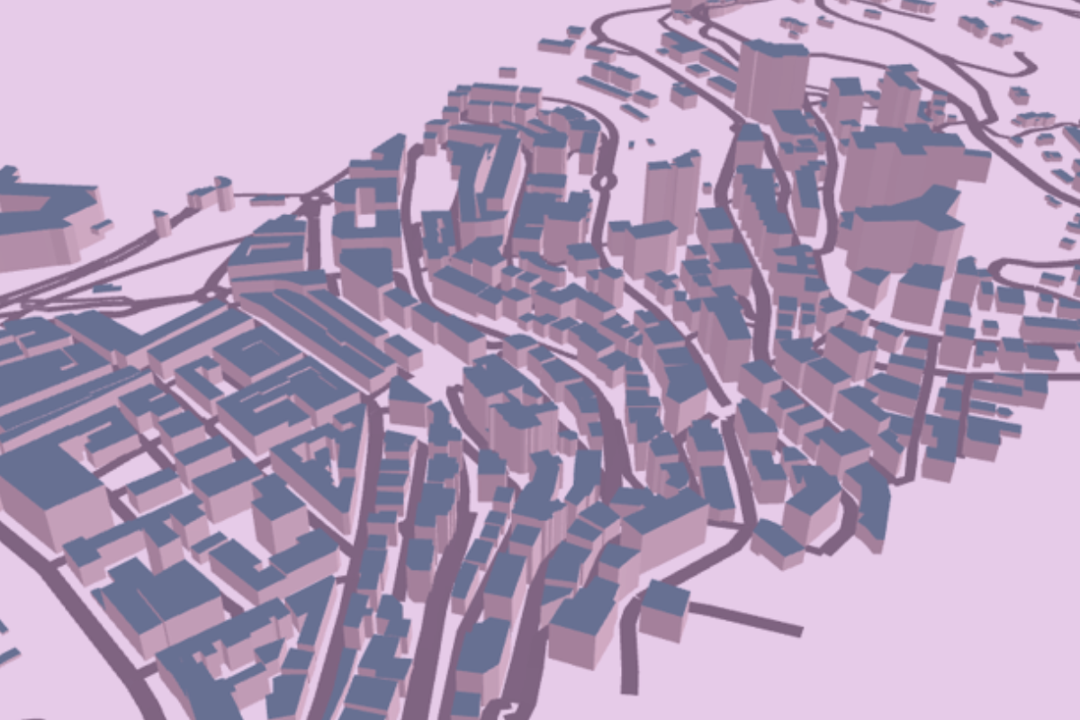
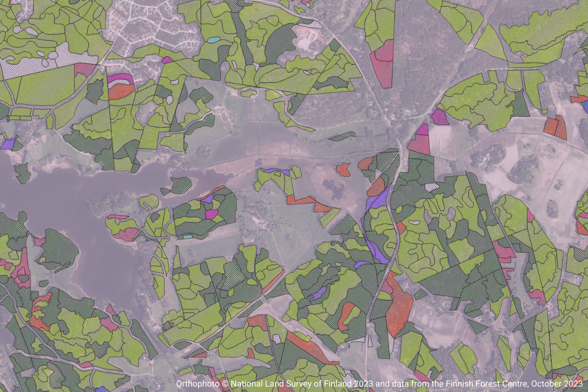
Built Environment & Smart Cities
Test new services and technologies in a real urban environment or use our data sets to develop new smart city innovations.
Providing organisation(s)
Finnish Geospatial Research Institute FGI
Description of the test environment
Location Europe data platform brings together national data sources from several European countries and offers data through modern OGC APIs to support innovation and easy experimentation. Datasets offered include buildings, roads, digital terrain models (DTM), digital surface models (DSM), and climate data. You can easily explore the data via our Explore page. New datasets are made available based on customer needs and ideas.
Purpose of use
Location Europe is a test-before-invest service for startups and small and medium-sized enterprises to innovate and develop new location-based solutions and business in Finland and assess their scalability across Europe. Spatial data available via OGC APIs offer possibilities for developers and other data enthusiasts to innovate and test new ideas, solutions and applications.
Use case(s)
With several datasets from different European countries available via OGC APIs, new possibilities emerge to combine data in unexpected ways, build innovative location-based solutions, and assess scalability across Europe. You can integrate data seamlessly into your own code or access it through geospatial software like QGIS. To inspire your work, we also provide an example use case of solar energy potential of a building.
Access / user rights
You can get an API key in seconds by submitting the form (https://locationeurope.eu/geoe3/lihp/getapikey) in our website.
Notes / restrictions
The service is intended for testing purposes. It cannot be used for commercial or operational services. The API key can only be used by businesses and organisations within the European Union. Private use is not allowed. The conditions of the original data and interface providers apply.
Required skills
- basics APIs (application programming interfaces)
- basics of querying OGC API - Features and OGC API - Coverages
- Basic programming knowledge or experience of geospatial software like QGIS
- Understanding of geospatial data
More information
Providing organisation(s)
Finnish Geospatial Research Institute FGI
Description of the test environment
Location Finland data platform brings together data sources and offers data through modern OGC APIs to support innovation and easy experimentation. Datasets are available in several themes: Built Environment, Forestry, Agriculture and Food, Transportation, Health and Wellbeing and Climate along with essential location reference data such as orthophotos. You can easily explore the data via our Explore page. New datasets are made available based on customer needs and ideas.
Purpose of use
Location Finland is a test-before-invest service for startups and small and medium-sized enterprises to innovate and develop new location-based solutions and business in Finland. Spatial data available via OGC APIs offer possibilities for developers and other data enthusiasts to innovate and test new ideas, solutions and applications.
Use case(s)
With several datasets from different themes available via OGC APIs, new possibilities emerge to combine data in unexpected ways and build innovative location-based solutions. You can integrate data seamlessly into your own code or access it through geospatial software like QGIS. To inspire your work, we also provide example use cases in areas of smart farming and smart cities.
Access / user rights
You can get an API key in seconds by submitting the form on our website.
Notes / restrictions
The service is intended for testing purposes. It cannot be used for commercial or operational services. The API key can only be used by businesses and organisations within the European Union. Private use is not allowed. The conditions of the original data and interface providers apply.
Required skills
- Basics of APIs (Application Programming Interfaces)
- Basics of querying OGC API - Features and OGC API - Coverages
- Basic programming knowledge or experience of geospatial software like QGIS
- Understanding of geospatial data
More information
Responsible organization(s):
Aalto University, the Research Institute of Measuring and Modeling for the Built Environment (MeMo)
Location:
Virtual open datasets
Description of the environment:
Aalto MeMo offers 3D point cloud datasets from selected cultural heritage sites, roadside environments, and built environment in Finland. Datasets contain real-world indoor and outdoor environments that are photorealistically modeled in high-fidelity using state-of-the-art techniques.
Purpose of use:
Aalto 3D Point Cloud Datasets are available to be explored, exploited, and utilized by all interested Aalto cooperation partners. Some limitations may apply.
Access/user rights:
Contact the Location Innovation Hub.
Notes/Restrictions:
Datasets are available upon request from Aalto MeMo with possible restrictions.
Responsible organization(s):
Forum Virium, Oulu Innovation Alliance
Location:
Helsinki, Oulu
Description of the environment:
- Our partners enable and support tests in urban environments & share their previous experiences.
- Open map data available as a basis, additional mobility datasets and digital twins.
Purpose of use:
- For testing new services and technologies in a real urban environment.
- For agile piloting: support with installations, rules, and regulations.
Access/user rights:
Responsible organization(s):
Sitowise Oy
Location:
Virtual
Description of the environment:
Test environment for demonstrating Smartlas map data collection. The environment connects Sitowise’s Smartlas map service and GEO map component for visualizing and testing purposes. Smartlas is cloud based service, which combines remote sensing data, spatial data and artificial intelligence modelling into automatically updating map data and reports. The service helps customers to stay up to date on the state of the environment, risks and development forecasts. The demo environment will be available in June 2025.
Purpose of use:
Smartlas offers a large collection of smart maps and reports for more sustainable land use planning, forest management, decision making and reporting. The target sectors are forestry, cities and energy companies. The results are available also via standard map data interfaces to 3rd party solutions.
Access/user rights:
Accessing the demo requires registration.
Notes/Restrictions:
Access to demo environment is free, but contents are restricted to limited geographical locations.
More information:
www.sitowise.com/digital-solutions/smart-analytics-and-maps/
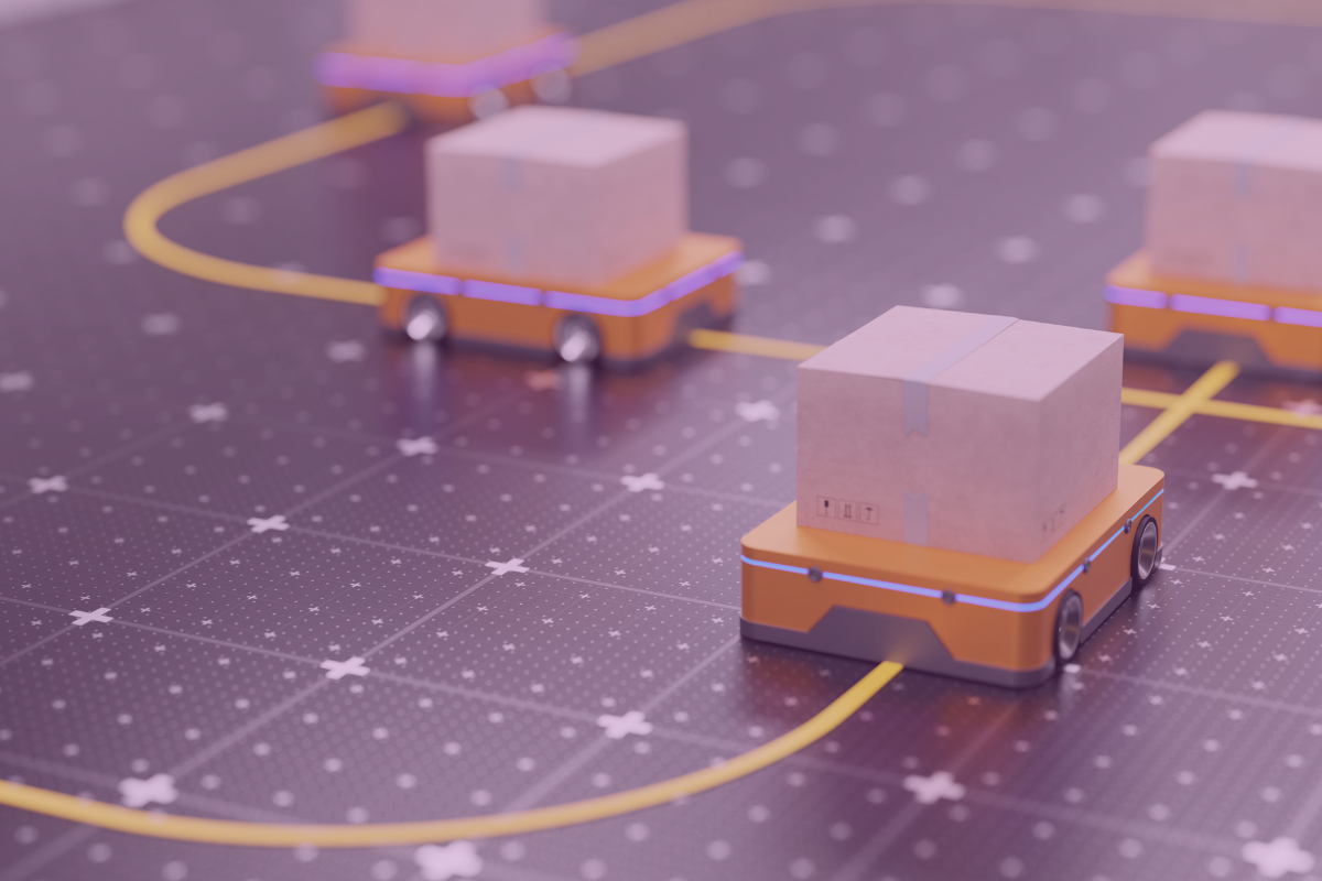
Logistics & Navigation
Test different indoor and outdoor positioning technologies and logistics solutions.
Responsible organization(s):
Finnish Geospatial Research Institute (FGI)
Location:
FGI Otaniemi premises, Espoo, Finland
Description of the environment:
FGI has developed a modular, scalable and easily extendable system to test indoor positioning software and hardware innovations.
The goal of the system is to facilitate testing, development and benchmarking of indoor positioning solutions at all levels:
- Hardware
- Software & algorithms
- Applications & UI
The system currently includes UWB and Bluetooth AOA functionality and allows easy addition of other solutions and sensors, many of which FGI can provide.
The system is designed for semi-permanent installation in Otaniemi premises, but a subset can be made portable.
Purpose of use:
The system can be tested by suppliers of indoor positioning technologies and applications, mainly at FGI's Otaniemi campus. This enables, e.g.testing of application ideas for a start-up without own infrastructure.
Access/user rights:
FGI provides support, including testing and development support to Location Innovation Hub customers.
To get access to the system, please fill in the Location Innovation Hub contact form and tell us more about your requirements. We will contact you and agree on testing.
Notes/Restrictions:
Access to Otaniemi premises requires at least visitor permissions.
More information:
Responsible organization(s):
HERE Technologies
Location:
Global
Description of the environment:
Worldwide accurate positioning SaaS Service using a combination of satellite, sensor, cellular and Wi-Fi signals.
HERE Network Positioning API v2 - Developer Guide (Freemium Plan Exist)
HERE HD GNSS and A-GNSS Positioning - Developer Guide (No Freemium Plan, Contact LIH for free trials / pricing).
SDKs and tools and for Android (Navigate Edition).
Purpose of use:
HERE Positioning is a suite of cloud-based services and SDKs to accurately locate devices and assets through the use of satellite (Global Navigation Satellite System, known as GNSS), cellular and Wi-Fi signals in different environments – outdoors under open sky conditions, urban environments where satellite signals may be compromised, as well as indoors. HERE Positioning has three components: HD GNSS Positioning, A GNSS Positioning and Network Positioning. They work together or independently to provide a comprehensive solution for highly accurate positioning.
Access/user rights:
Limited Plan includes 5000 location services API requests a month. Contact the Location Innovation Hub.
Notes/Restrictions:
More information
Contact Location Innovation Hub or visit www.here.com

Mobility Data & Platforms
Use our mobility data sets and platforms to develop better services.
Responsible organization(s):
FGI, NLS
Location:
Virtual
Description of the environment:
Open web service, everyone may register as a user. Registered users can donate their movement trajectory data for science. In addition, they can share the anonymized versions of the trajectories to the open database.
Purpose of use:
A pilot service of a research project. The purpose is to allow the use of personal level trajectory data, for example, in science and city planning while preserving the privacy of the individuals.
Access/user rights:
Open service, anybody can register as a user.
Notes/Restrictions:
The terms of use of the service and the open data can be found on the web page. Only trajectories within Finland and in areas where the population density is high enough are accepted.
Location Innovation Hub offers consultation and support. Contact us.
More information:
Responsible organization(s):
Telia
Location:
Oulu region
Description of the environment:
Activity-homezone data
Activities on grid level for the entire Oulu region
Homezone on a zipcode level (or at the grid level if the data service does not have a grid-zip combination)
Work-home-other-total classification
Time Period: September 2022
Temporal granularity: daily
Activity definition: typical 20 min break
Travel data
Municipality-level ODM
Area: Oulu (+Hailuoto, Ii, Kempele, Liminka, Lumijoki, Muhos, Pudasjärvi, Siikajoki, Tyrnävä, and Utajärvi)
Time Period: September 2022
Temporal granularity: hourly level
Definition of distance: dynamic definition
Purpose of use:
Analysis of crowd movements, urban planning, public transport planning etc.
Access/user rights:
Contact the Location Innovation Hub.
Notes/Restrictions:
The customer can use the data for research purposes related to the Location Innovation Hub. The data cannot be used for commercial purposes, or given or passed on to anyone without Telia’s written permission.
More information:
https://www.telia.fi/yrityksille/palvelut/teknologiat/crowd-insights(in finnish)
Location Data Analysis & Visualisation Environments
Manage, publish, and share location data with free GIS platforms and API software.
Responsible organization(s):
Esri Finland Oy
Location:
Virtual
Description of the environment:
Digital Atlas is an easy-to-use map application that introduces you to the use of spatial data and related technology. It contains ready-to-use map layers that you can use, for example, to combine and visualize data on a map. Presenting global and local phenomena on a map helps you perceive and understand the world around us in a whole new way.
Purpose of use:
An easy-to-use map application for all users, especially for SMEs and public sector. The map application offers an easy way to explore and experiment with spatial data sets and applications.
Access/user rights:
Contact the Location Innovation Hub or Saara Heikkinen, Esri Finland Oy.
Notes/Restrictions:
The service is public and free of charge for the end user.
More information:
Responsible organization(s):
Gispo
Location:
Virtual
Description of the environment:
A Web GIS framework that can be used to create, manage, and share maps, dashboards, and stories. These can be created by mixing geospatial contents from servers compliant to OGC standards (WFS, CSW, WMS, WMTS, Google Maps, OSM). Based on OpenLayers, Leaflet, and ReactJS.
Purpose of use:
For those who wish to manage maps and dashboards while helping to convey visually the key highlights of geospatial context. The service is used to find, view, and query published geospatial data and to integrate multiple sources into a single map.
Access/user rights:
Licensed under the Simplified BSD license. More information at github.com.
Notes/Restrictions:
MapStore is Free and Open source software. Registration is not required. Location Innovation Hub offers consultation and support. Contact us.
The environment is developed by GeoSolutions.More information:
Demo available at mapstore.geosolutionsgroup.com
Instructions for a quick start: docs.mapstore.geosolutionsgroup.com
Responsible organization(s):
Gispo
Location:
Virtual
Description of the environment:
An open-source platform for visualizing and analyzing geospatial data. Can be run both locally and on-browser. Kepler utilizes WebGL to render datasets, making it a powerful tool even for large-scale datasets. Built on top of Mapbox GL and deck.gl.
Purpose of use:
For the creation and publication of visually striking interactive maps. Can be especially useful in situations where the installation of any desktop software is to be avoided, and the service allows quick exploration, visualization, and demonstration of data.
Access/user rights:
Kepler.gl is under the MIT License. It is an open-source, register-free service that runs on a web browser but can be built, customized, and run locally. Can be used by anyone for free.
Notes/Restrictions:
Location Innovation Hub offers consultation and support. Contact us
More information about Kepler’s contributors and development can be found on GitHub.More information:
More about Kepler on its website at kepler.gl. Kepler’s demo website available at kepler.gl/demo.
Responsible organization(s):
Gispo
Location:
Virtual
Description of the environment:
An open-source geospatial content management system and a platform for geospatial data management and publication. The interface is easy to use and allows anyone to share data and create interactive maps. The service includes data management tools for creating and editing data.
Purpose of use:
For developing geospatial information systems (GIS), deploying Spatial Data Infrastructures (SDI), and creating interactive maps.
Access/user rights:
GNU General Public License. Register as a user for GeoNode Live Demo at demo.geonode.org. Please keep in mind that the uploaded data on the demo service will be deleted once a week as the demo is restored to a clean state, but any created accounts will be maintained.
Notes/Restrictions:
Instructions for configuration, installation, etc. at geonode.org. The environment is designed by GeoSolutions and GeoNode contributors (GitHub).
Location Innovation Hub offers consultation and support. Contact us.
More information:
Responsible organization(s):
Gispo
Location:
Virtual
Description of the environment:
A distributed and extensible open-source geoportal built with Java and Javascript. The service uses standard open-source components such as OpenLayers, GeoTools and GeoServer
Purpose of use:
For building multipurpose web maps by utilizing spatial data. Compliant to the EU directive INSPIRE and OGC standards, for example. For displaying and analyzing geospatial data
Access/user rights:
Source code is released with dual license: MIT and EUPL v.1.1. More information about the licenses can be found National Land Survey of Finland.
Location Innovation Hub offers consultation and support. Contact us.
More information:
Technical instructions for using, configuring and developing the software at oskari.org/guides.
Responsible organization(s):
Gispo
Location:
Virtual
Description of the environment:
An open-source web software developed to be compatible with QGIS and QGIS server. There is a QGIS plugin available that helps publish maps with the data description and styles originally defined in QGIS. The service also has its own control panel that allows the user to define the rights to view published maps, layers, etc., and define the layout of the map service.
Purpose of use:
Essentially for creating web map applications with QGIS Desktop. Geospatial data created and edited in QGIS can be published as a map application online (on Lizmap Hosting or own server) while maintaining the data description styles defined in QGIS. Alternatively, the map service lets the user configure the layout by using its own control panel.
Access/user rights:
Mozilla Public License 2.0. Open source software and free to use. Registration is not required.
Notes/Restrictions:
Location Innovation Hub offers consultation and support for both using the plugin and the service. Contact us. The environment is designed by 3Liz. Can be installed on the user's own server, but setting up and maintaining a server can be time-consuming and complicated. There is a Lizmap QGIS plugin that helps the user with configurations. Using Lizmap Hosting requires a subscription plan, and more information about the available plans can be found at lizmap.com.
For the best user experience, it is recommended to use the same version between QGIS Desktop and QGIS Server. Installing the Lizmap QGIS plugin is recommended. (More information about requirements before installing).
More information:
More information available at lizmap.com/en. Online demos available at demo.lizmap.com/lizmap.
Responsible organization(s):
Gispo
Location:
Virtual
Description of the environment:
Open-source TypeScript library for publishing maps on a website that is based on GPU-accelerated vector tile rendering. The service is fully compatible with Mapbox GL JS v1 which allows the user to migrate existing Mapbox v1 solutions to MapLibre. Maplibre Native can be also used for Android and iOS allowing displaying maps inside of your mobile applications, desktop application, or embedded devices.
Purpose of use:
For publishing maps on a website while allowing customization of map styles which complies with the MapLibre Style Spec (maplibre.org/maplibre-style-spec).
Access/user rights:
Information about licensing can be found at GitHub (github.com/maplibre/maplibre-gl-js).
Notes/Restrictions:
Location Innovation Hub offers consultation and support for both using the plugin and the service. Contact us. The environment is provided by The MapLibre Organization (maplibre.org/about).
More information:
Responsible organization(s):
Gispo
Location:
Virtual
Description of the environment:
Maputnik is an online open source visual editor for the Mapbox Style Specification. Written in ES6 and uses React and Mapbox GL JS.
Purpose of use:
For those who wish to use an easily accessible online visual editor for designing a map style.
Access/user rights:
Licensed Under MIT and is Copyright © Lukas Martinelli and contributors. More about licensing at GitHub (github.com/maputnik/editor).
Notes/Restrictions:
Location Innovation Hub offers consultation and support for both using the plugin and the service. Contact us. More about the contributors can be found on the GitHub page of Maputnik.
Noteworthy that the project is not affiliated with Mapbox or Mapbox Studio and is an independent style editor for the open source technology in the Mapbox GL ecosystem.
More information:
More information available on Maputnik’s GitHub page at github.com/maputnik.
Responsible organization(s):
FGI, Spatineo
Location:
Virtual
Description of the environment:
OGC APIs are designed to make it easy for anyone to provide and use geospatial data on the web, and to integrate this data with any other type of information.
Purpose of use:
OGC APIs can be used to query, visualise and manipulate data over interfaces in most of the desktop GIS software.
Access/user rights:
Location Innovation Hub offers consultation and support for OGC APIs. Contact us. OGC standards are open standards.
Notes/Restrictions:
Restrictions may apply to the data queried through OGC APIs. OGC standards on their own are open standards.
More information:
More information at https://ogcapi.ogc.org/#guidelines
Responsible organization(s):
FGI, Gispo
Location:
Virtual
Description of the environment:
PostGIS extends the capabilities of the PostgreSQL relational database by adding support for storing, indexing, and querying geospatial data. PostGIS follows the Simple Features for SQL specification from the OGC.
Purpose of use:
PostGIS allows users to store spatial data, do spatial indexing, spatial functions, geometry processing, offers raster data support as well as geocoding and reverse geocoding functions.
Access/user rights:
Location Innovation Hub offers consultation and support for PostGIS. Contact us. PostGIS operates under General Public License and thus guarantees end users the four freedoms to run, study, share, and modify the software.
Notes/Restrictions:
Requires PostgreSQL. PostGIS operates under General Public License.
More information:
More information at https://postgis.net/
Responsible organization(s):
FGI, Gispo
Location:
Virtual
Description of the environment:
A Free and Open Source Geographic Information System with which you can create, edit, visualise, analyse and publish geospatial information on Windows, macOS, Linux, BSD and mobile devices.
Purpose of use:
The service is especially useful for those who have data that can be linked to a geographical co-ordinates. QGIS is a tool that can be used to create new geospatial data, visualise existing data, combine various data sources, as well as run analysis on the data. QGIS also offers a variety of plug-ins for various of use cases.
Access/user rights:
Location Innovation Hub offers consultation and support for both using the plugin and the service. Contact us. QGIS on its own is a free to use software.
Notes/Restrictions:
QGIS is an open-source geographic information system software, which means that it can be freely used, modified, and distributed by individuals and organizations.
More information:
More information at https://www.qgis.org/en/docs/index.html
Responsible organization(s):
Gispo
Location:
Virtual
Description of the environment:
A web-GIS platform for publishing maps, data, and service. It is also a QGIS plugin that helps upload on the QGIS Cloud service, which is a personal Spatial Data Infrastructure (SDI) on the internet. It allows the user to publish QGIS projects as maps and data.
Purpose of use:
The service is especially useful for those who wish to publish their QGIS projects online while keeping all the styling options and configurations made in QGIS Desktop. QGIS Cloud is a platform that allows publishing maps, and practically all configuration work can be managed with QGIS. The QGIS Cloud plugin then lets the user upload local data to the QGIS Cloud database and publish web maps and OGC compliant services.
Access/user rights:
Gispo offers consultation and support for both using the plugin and the service. The service is provided by the company Sourcepole. For testing and non-commercial activities, you may use QGIS Cloud Free. However, for commercial or government applications, a QGIS Cloud Pro subscription is needed.
Notes/Restrictions:
QGIS Cloud Free allows publishing freely accessible maps on the internet. Limiting the access of the maps requires a QGIS Cloud Pro subscription.
More information:
Responsible organization(s):
Gispo
Location:
Virtual
Description of the environment:
A QGIS plugin that can generate a web map from a QGIS project as openLayers, Leaflet, or Mapbox GL JS. It replicates different aspects of the projects such as layers and styles. No server-side software is required, and it is possible to set the web map to have popups, clusters, and different kinds of properties and widgets such as a measuring tool and address search. The plugin takes all of the layers of the map from QGIS desktop and creates all the supporting files to build a web map.
Purpose of use:
A plugin for QGIS desktop that lets you publish interactive maps for the web that include layers and their styling. It’s especially for those who wish to create maps with QGIS desktop and want to effortlessly generate a web map of them.
Access/user rights:
GNU General Public License v2.0. More information at GitHub. An open-source plugin for QGIS Desktop and its source code can be viewed and edited by anyone. Requires QGIS desktop installation and then installing the plugin.
Notes/Restrictions:
Gispo offers consultation and support for using the plugin. It is fundamentally a merge of qgis-ol3 and qgis2leaf. More about the credits can be found on the GitHub page of QGIS2Web.
More information:
More information on QGIS2Web’s GitHub page.