
Location Finland – a new test platform helping businesses and the public sector make better use of data
04.12.2025
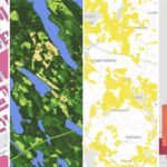
Geospatial Challenge Camp is looking for business partners
15.12.2025
Make a BIM: Revolutionising 3D Building Modelling with AI
Make a BIM is a Finnish startup developing solutions to automate building BIM modelling with artificial intelligence. The company’s application automatically converts traditional 2D drawings into 3D BIM (Building Information Model) models — saving time and enabling more accurate planning and building management.
Conventional BIM processes often require extensive manual work and time. Make a BIM’s solution speeds up this process significantly, creating major benefits for example in renovation projects, energy-efficiency optimisation and the circular economy.
Building information modelling plays a central role in the digitalisation of the construction industry. The idea behind Make a BIM originated from the founders’ frustration: why had such an essential process not been automated already?
“In building-related work, a surprising amount of manual and repetitive work is accepted as normal. Data is repeatedly extracted from drawings into structured formats — Excel, CAD and BIM — by hand. And despite decades of attempts, there still wasn’t a solution that truly worked,” Leo Salomaa, founder of Make a BIM, explains.
This is not only an internal industry challenge. According to the EU, buildings account for around 36% of greenhouse gas emissions, arising mainly from heating and cooling spaces but also from concrete production.
“Better energy simulations enable data-driven renovation that is both cost-effective and environmentally sustainable,” Salomaa says.

Make a BIM is a Finnish startup that has developed a tool for generating building information models directly in your web browser.
Collaboration and support accelerated growth
In spring 2023, Make a BIM won the Location Intelligence for Smart Cities hackathon co-organised by the Location Innovation Hub. The company was founded later that same year. The Location Innovation Hub supported Make a BIM in its early stage with, among other things, funding and IPR advisory.
Since then, the company’s growth has been rapid. Today, Make a BIM already serves major players in the construction industry and has raised growth funding to expand operations and continue developing its tools. The main investor is Kiilto Ventures.
“We have actively participated in various startup programmes and received valuable mentoring from our investors as well. For early-stage entrepreneurs, any support that helps build connections to potential customers is incredibly valuable. In B2B, this usually means building connections with large, established companies,” Salomaa notes.
Next, Make a BIM is aiming for further international growth.
“We are particularly pleased that companies as far as the United States and Asia have already discovered us and used our AI directly through our website. We are currently focused on ensuring our AI produces increasingly accurate, independently generated information models tailored to customer needs,” Salomaa says.
In the longer term, the vision is that Make a BIM’s tool could model thousands of buildings at once — combining drawings, documents, photographs and point clouds.
“Bringing all that data together would be truly disruptive. It would multiply the industry’s productivity and create a new market for intelligent building solutions,” Salomaa envisions.
- Find out more about Make a BIM on their website: makeabim.com
If you are a startup or SME looking for support, such as technical or business advice, on your journey, get in touch with Location Innovation Hub. Learn more about Location Innovation Hub’s services and contact us.


